Lower Dolpo Trek - 18 DaysLower Dolpo Trek - 18 Days

Lower Dolpo Trek - 18 Days

  • Duration18 Days
  • DestinationNepal
  • Difficulty Challenging
  • Max Altitude 5309m
  • Activity Trekking and excursion
  • Group Size 2-10
  • Accommodation Comfort Hotel & Tented
  • Meals Serve from Kitchen crews
  • Transportation Flight - Private vehicle
  • Starts Trek from Juphal
  • Ends To Juphal
  • Best Season April - until mid of November
Overview
Trip Highlights
  • Witness the age-old Bon-Buddhist practices in different monasteries
  • Trek to the pristine Himalayas and arid landscape
  • Off the beaten region with Sangrila- La views
  • amazing experience in rain shadow area with high passes of Bagala and Numala pass
  • Follow the footprints of Himalayan traders & Yak Caravan
  • The deepest Phoksundo Lake in Nepal
  • Phoksundo National Park which is Amazing for flora and fauna

Dho

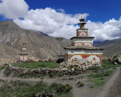
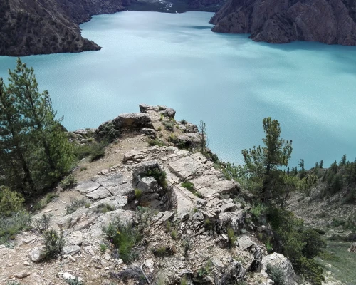
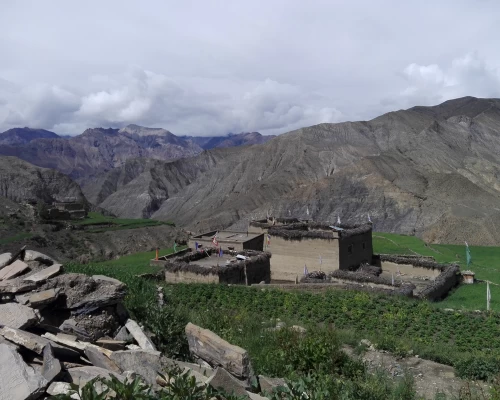
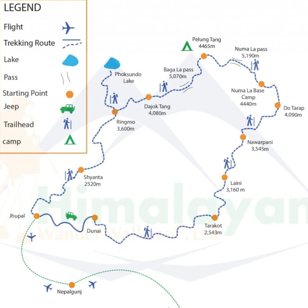
In lower Dolpo, It is believed that the famous Bodhisatwa Padmasambhava (Guru Rinpoche) has visited and meditated along this valley so it is called the valley of natural hidden wonders. Dolpo is the land of tranquil natural beauties, herbal land, unspoiled trans-Himalayan culture, and Buddhist civilization. Dolpo was opened just in 1989 for outsiders. Dolpo is still out from regular outsider contact, thus the typical virginity of primitive Dolpo is well-conserved. Ancient lifestyles, unique cultures, languages, and traditions are yet unspoiled. The lunar-looking land has verities of alpine flora and fauna. Dolpo region lies behind the mountains or backdrop of Mt. Dhaulagiri so there are very few rainfalls, people have alpine seasonal agriculture, and animal husbandry for trans-Himalayan trading and livelihood. Trekkers have to traverse through two high passes: Numa La Pass (5309m), the highest point of the trek, and Baga La Pass (5169m) both these passes offer extraordinary views of Mt. Dhaulagiri (8167m) and the Tibetan ranges—Kugung La and Khyung La. During summer, we can see the caravans of yaks and sheep heading toward their destination. Another highlight of the trek includes the pristine turquoise Phoksundo Lake, split between rocks that rise 2000m into the clear mountain skies. The Dolpo region is populated by Tibetan and Magar people who still practice the pre-Buddhist Bon Po religion. The trek also includes visits to the ancient monasteries (gompas) and Bon Po shrines surrounding the Phoksundo Lake.

Itinerary

Arrival at Tribhuwan International Airport. Greeting you with fresh flower garland Mala and transfer to your hotel and free time. Trip briefing at the evening with farewel dinner

The company will prepare your Dolpo trekking permit. You make a city sightseeing around the UNESCO's Cultural World heritage and preparation for the trip ahead. If your 2nd day after your arrival in Nepal is Saturday then the permit will not be ready because Saturday is weekend day in Nepal. The offices will be opened from 10:00 AM to 4:00PM from Sunday to Frieday. Original Passport with Nepal entry visa of trekkers is required for the restricted trekking permit procedure so that Permit process will be applied after your arrival in Nepal.

Nepalgunj is another big city that lies close to India in the southwestern part of Nepal. Nepalgunj is in the Terei region so it has a very low temperature. It is almost impossible to walk around in the city by the Sunny day during hot (Spring/ Summer) Season. We prefare in the afternoon flight from Kathmandu to Nepalgunj. So that you will arrive Nepalgunj by a little comfort temperature. The hotels have very nice room with perfect air conditioners and restaurant.  

The flight takes 35 minutes from Nepalgunj to Juphal. Prepare your bag sacks and start your trekking. The trail descends to the large village of Dangi Bhara to Khala Gaura. We should walk along the rough and dusty road from Kala Gauda to Dunai the headquarter of Dolpo District. We will meet all our trekking crews in Dunai. 

Juphal

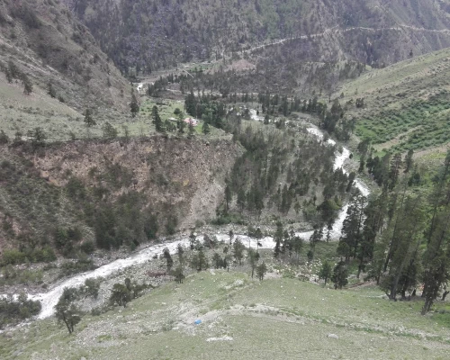
Following the trail eastward along the South bank of the Bheri crossing to the north valley and follow the River bank until you reach to Tarakot. The trail does not climb but often leads along the rough tough newly built road to the Tarakot village. It is very humidity trekking for the day due to the walking via River bank.

A long zigzag ascending and descending trail along the Tarap village, Laisicave,  Khanigaun to Lahini.

Ngawarpani

The trail forwards on stone stairways and twisting baren-earth to reach the high point of about 3650m then downhill to Chukore and gradual flat to Ngawar pani along the bank of Bheri River

Crossing the streams and bridges, passing the series of caves, the large yak pasture of Kamokharka, and along flat up and down to Dho. The trail for the day is not difficult but very long.  Nowadays the rough road is extending from Toltol to Dho village. The road walk is easier however it is often dusty, some times a TUKTUK is available at a chance but you have to make deal for good price.

Today we can climb a little hill in front of Dho for ensuring acclimatization and a day excursion around the village.

Dho

From the Dho trail heads gradually climbing to Tok-Khyu village (4180m). Then the trail crosses the Tarap Khola and ascends across the hidden valley to Numa La base camp. The main trail does not seems like a major trail around the pasture open field, the trail infront one seems like a Major trail but that goes towards Shey Gumba via some hidden passes. Do not hesitate to keep following the left trail to uphil along the little river stream. After 40 minutes you approach to the ascending rocky trail below the hiltop prayer flags. Numa- La Base Camp is situated on the stream bank of pastoral cornerside. If drinking water is available and your physical condition is going well then you can proceed 1 hour of uphill climbing to the High Camp. That provides the best views and make easier for next days trail to the Numala Pass.

Numala BC

The trek climbs along moraine pastural trail to Numa La (5238m) pass. From the pass, Shey Shikar (6139m), Kanjirowa, Chharka-La, and Dhaulagiri I (8169m) are well visible. The trail descends steeply down to the valley by following the River streem. The dried landscape and Copper colored stream bank trail goes until the longway down to the valley then turn to the left gradual slope up trail by leaving the right trail.  The trail slightly climbing up towards left valley from the River bank. It reaches to Danigar in one and half hours of walk. There is often a yaks pastural tent hut and Danigar, very famous NURBU KHANG Ri 6061Mtr is perfectly visible from your camp side. stop your camping near the River side.

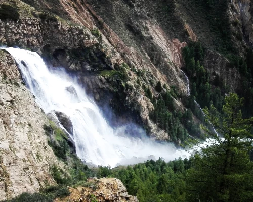
The trail crosses the stream then climbs slope hills, Poyun Chu Valley, and to Baga La (5190m) pass then a long steep descending to Sanubheri Valley to Roman pasture field which is very flat and romantic. The waterfalls, beautiful amazing high peaks are visible from the flat pasture. So we recommend you to stop here for camping.

Bagala BC

Trek through the meadows, Valley, yak pasture blue pine forest, and old abandoned yak pastures via rocky and narrow hilly passes. The trail in the rocky area is a bit scary and try climbing. Sometimes Blue sheep graze up there on the cliff so they may roll down rocks so we often keep attention to rolling rocks. After this climb the beautiful birch and pine forest, pass through, and reach the mind-blowing viewpoint for waterfalls, Lake and valley then reach Phoksundo Lake by noon. You have a free day…

Take a shower, wash your cloths or have very wonderful day today. Visit the old Bonpo Monastery beyond the Lake which is about 6 hundred years old, viisit around the lake and village tour before lunch. If you feel comfortable then climb up to Phoksundo viewpoint for beautiful picture at the Noon time. 

phoksundo

Today we trek alongside Phoksundo Khola, we cross the river several times over traditional and suspension bridges. Walking in deep alpine forests and bushes by passing several villages to Chhepka for overnight

Follow the same river valley until Sulighat. There is Phoksundo national park office and check post of your Dolpo permits. Cross the bridge and turn to the Bheri river bank to the Rupghat. Walk for a while along the road and follow the village path just up to Juphal airport. Or you can hire a BOLERO Jeep drive to Juphal from Sulighat.

Chhepka

Farewell dinner all together, you distribute TIPs for your staff as thanks for entire tour, and kitchen staff offer the delicious last meals of the trekking

Take a morning flight to Nepalgunj and direct another flight to Kathmandu. Free time in the evening

Cost Details

We offer every trip on a very essential cost basis. We provide special discounts for larger groups, Travel Companies, Partner Agent and non profit Organizations.

What's included

Airport picks drop by private /car/van/bus

2 nights Hotel accommodation (Twin bedroom) in Kathmandu before the trekking on BB planning.

1-night Hotel accommodation (Twin bedroom) in Kathmandu after the trekking on BB Planning.

1-day city sightseeing tour in Kathmandu with a cultural tour guide

Private vehicle for sightseeing in Kathmandu

1-night Hotel accommodation (Twin bedroom) in Nepalganj on BB planning

Trekking permit for lower Dolpo & government taxes

Trekking equipment for trekking such as a sleeping tent, dining tent, toilet tent, table, chair, mattress, and pillow.

3 times meals in a day (breakfast, Lunch, dinner) prepared by our private cook.

Necessary trekking staff, and porters with their wages and insurance.

Air ticket from Kathmandu-Nepalganj-Juphal-Nepalganj-Kathmandu as well as domestic airport tax

First aid medical kid

Travel & rescue arrangements

All ground transportation for your trekking staff

Farewell dinner in Kathmandu

What's not included

Lunch & dinner during your stay in Kathmandu and in Nepalgunj

Personal medical expenses

Entrance fees for sightseeing

Rescue helicopter price in case necessary

Personal expenses and equipment

Bottle and can beverages

Travel Insurance

Tips for your staff ( at the end of the trekking)

Extra Hotel room in- Case you are staying longer than our program In KTM after the trekking.

Useful Info

Would you be able to get to Dolpo?

Most travel companies offer it by flying in and flying out. Access is more difficult in remote parts of Western Nepal than in other parts of Nepal. To get into Dolpo you have to fly first from Kathmandu to Nepalgunj city on the plains near the Indian border and have to spend overnight. Then the next morning flight from Nepalgunj to Juphal in Dolpo district. There is also road accessibility from Kathmandu to Nepalgunj but it is a quite long trip. Nepalgunj to Dolpo is also connected with off-road now. It takes roughly 3 days off-road bumpy hard drive but depends on the season. In rainy season direct driving is impossible.

There is no direct flight from Kathmandu or Pokhara to Jufal but if you are a big group or able to offer chartered flights or helicopter then it is possible without spending a night in Nepalgunj. Juphal is a small mountain airstrip and often bad weather delays flights.

Accommodation & Meals

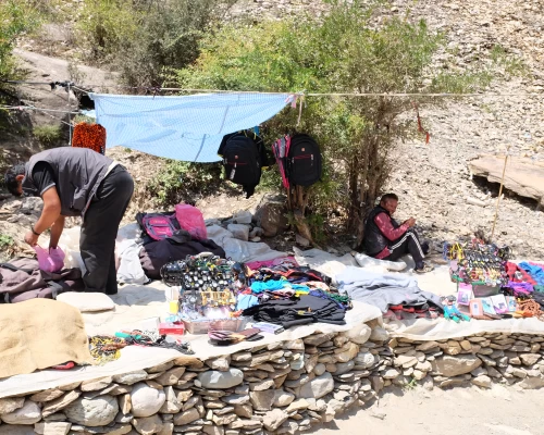
You can buy some local items such as barley flour, rice, potatoes Champa, and seasonal vegetables but should not be relied on. That’s why most food storage should be carried by oneself. You will have your cook, kitchen boy, spare boy, Sherpa man, and necessary mules for carrying gear with a driver for the entire tour including a professional guide. The kitchen team will supply breakfast, lunch, and dinner with hot drinks.

Such as for kitchen tents, toilet tents, dining tents, sleeping tents, sleeping bags, and good mattresses will be delivered. In some places, you can find some basic tea houses and simple accommodation.

Difficulty

Trekking in Dolpo is considered strenuous. There are steep ascends and descends and many passes above 5000 m., We have to sleep several nights above 3500 m, and some days trekking will be more than 10 hours long in a dried and dusty landscape. The Dolpo trekking is completely outfitter and physically challenging in the arid landscape.

Permits & Regulations

You need to have a special permit or (restricted permit) for upper Dolpo. There should be at least two trekkers in a group. Permit won’t be issued for single person or individual trekkers.

Lower Dolpo: U.S. $ 20 USD per week and U.S. $ 5 per day for additional days.

Upper Dolpo: U.S. $500 for 10 days and U.S. $ 50 per day for additional days.

There is also a Rs. 3000 entry fee to the Shey-Phoksundo National Park.

Personal equipment list:

Good walking boots, a pair of track shoes and slippers to wear in the camp in the evening or when the boot is wet.

Warm jacket (Fibers fill or down should be adequate.)

A Rainproof jacket with a hood or poncho.

Woolen shirts and thick sweaters or fleece jackets.

Thin and thick trousers.

Trousers for higher up in the mountains in the morning and at night. Windproof/ waterproof trousers are necessary during treks going above 3000mtr.

Thermal underwear (These are excellent to sleep at night)

A tracksuit for wearing in camp. 2 pairs of loose-fitting long shorts/ skirts. 1 lightweight long-sleeved –shirt is particularly suitable for avoiding sunburn.

A woolen or warm hat to wear in the morning and at night. Sunhat and ensure it has a wide brim to cover the face and neck.

A pair of gloves and good sun/snow glasses (warm and normal ones)

2 pairs of thin and 2 pairs of thick warm socks, Underwear, buff, and hankies as you need.

Necessary personal items if you are a woman.

Accessories

Duffle bag or kit bag to carry gear while trekking, sleeping bag. Small rucksack to carry personal requirements for the day e.g. toilet paper, camera, film towel, soap, etc. Water bottle. Snow glasses and sunglasses, 2-4 large plastic bags to separate clean clothes from dirty ones. Headlamp with spare batteries, Snow gaiters, sun cream, personal medicine, lip guard, toothbrush, towel, Reading materials, camera, game items (optional), notebook, rubber band, pen and pencil, a diary, a pocket knife, trekking map, passport, and copies.

Drinking Water:

Travelers should be very aware of drinking water in Nepal. They are not completely adapted to digest direct normal spring water due to bacteria. So, we recommend you drink mineral water or boiled water. Also, you can use some purifier tablets such as chlorine tablets for purifying water on the trekking. We strongly recommend mineral water in the city area and purified or boiled water in the trekking.

Meals:

We will provide 3-time meals in a day on the trekking (breakfast, lunch, and dinner) as well as hot drinks like tea, coffee, and boiled water for drinking or filling water bottles….. Etc. But we won’t provide lunch and dinner during your stay in the City.

Battery Charging: 

Battery charging on electricity is almost not available in this trek. So that we recommend you to bring either solar charger or enough powerfull power Bank. You get electricity and Solar pannel charger in some parts then nothing around the camping areas.

Altitude sickness

Altitude sickness (acute mountain sickness) is difficulty sleeping, dizziness, headache, fatigue, loss of appetite, rapid pulse, nausea, vomiting, etc. It affects mountain climbers, hikers, and skiers because of lower air pressure and lower oxygen levels. It occurs as the result of failure to adapt to a higher altitude. It happens most often in the brains or the longs after the fluid begins to leak from the blood vessels.

When the fluid collects in the brain, you initially get headaches, loss of appetite, nausea, tiredness, want to lie down and do nothing, and a decrease of consciousness, and the problem with balance coordination is called high–altitude cerebral edema (HACE). If the fluid is collected in the lungs, you become breathless and dry, and an irritative cough begins, coughing up blood, discoloration of the skin, and chest tightness is called high altitude pulmonary edema (HAPE).

Prevention

To prevent acute mountain sickness; we have to follow fundamental gravity habits such as patience, consistency, and discipline in the mountain. Avoid rapid altitude gaining, drink enough water or fluid, acclimatize to adjust the body at a higher altitude, avoid alcohol, eat regular meals, get higher and sleep at lower altitudes, and avoid high altitudes if you have heart and lung disease. The main treatment for acute mountain sickness is to stop climbing and descend to a lower altitude if the symptoms occur.

If the person is seriously sick, or cannot bring him/her lower altitude by walking and carrying then we need a helicopter charter for quick evacuations.

Similar Packages