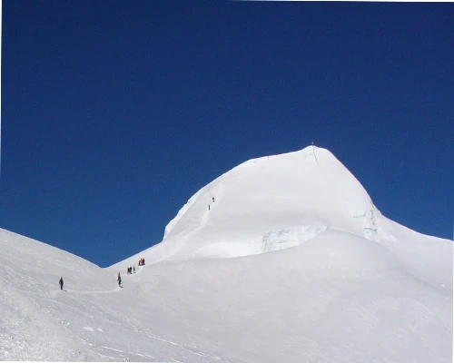
Gokyo Trekking (13 days)Gokyo Trekking (13 days)

Gokyo Valley Trek in the Everest

  • Duration12 Days
  • DestinationNepal
  • Difficulty Moderate to Challenging
  • Max Altitude 5,380m
  • Activity Trekking
  • Group Size 1-20 people
  • Accommodation Comfortable Hotel & Lodges
  • Meals Breakfast, Lunch & Dinner as per own choices
  • Transportation Private Vehicle- Flight
  • Starts From Lukla
  • Ends To Lukla
  • Best Season March-April- May/ September-October- December
Overview
Trip Highlights
  • Highly experienced trekking crews
  • Guided Sightseeing tour around the world heritage sites and trekking,
  • Private vehicle to and from Ramechaap, domestic flight to and from Lukla,
  • Following a holistic and shepherded path, beautiful Himalayan wildlife,
  • Breathless high alpine pastures and landscapes,
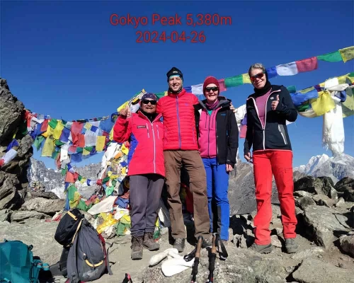
  • Gokyo Ri viewpoint 5,380m
  • Astonishing panoramic views of lakes and several peaks,
  • Views of the Mt. Everest 8,848m, Lhotse 8,516m, Lhotse Shar 8,383 m, Makalu 8,485m, Cho-Oyu 8,201m,
  • Picturesque Sherpa villages, mane walls and bridges,
  • Buddhist culture, traditions, Monastery, Lungdars, stupas and chortens,
  • Enormous scenic glacier, landscape, icefall, and moraine,
  • Nice hotels and lodges with a delicious food menu,
  • Kneed and clean dining room with yak dung heater,
  • Hot showers and comfort toilets,

The Gokyo  "Holy valley" trek in the Everest

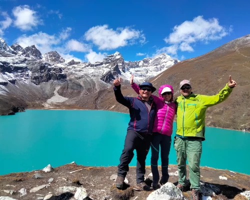
Gokyo Lake

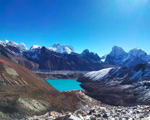
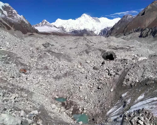
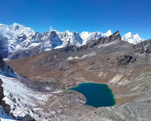
Gokyo Valley is one of the best trekking destinations for those who have limited holiday time in the Himalayas. Definitely, Gokyo Ri is the best viewpoint in the Khumbu region. Trekkers can have a wonderful panoramic view of Mt. Everest 8,848m, Lhotse 8,516m, Lhotse Shar 8,383m, Makalu 8,485m and Cho Oyu 8,201m and several other mountains such as Mt. Pumori (7161m), Ngozumba, Gyazungkhang, Tawatse, Cholatse, Mt. Changste (7550m), Mt. Lingterin (6679m), Mt. Amadablam (6856m), Bharuntse, Thamserku (6723m), Kantega( 6685m), etc. This trek takes you to the greatest Ngozumba glacier, the holy Gokyo Lake. You may be spellbound by the view of a huge, incredible glacier bedding down from the mountains. The massive Ngozumba glacier is 36 KM long, 1 KM wide, and extends from 4700m up to 8000m. The Gokyo area is known as a Holistic valley in the Khumbu region. Earlier, Gokyo Lake used to be called Dudh Pokhari (milky pool); the famous Dudh Koshi River begins from this lake. The Lake water springs out from the Ngozumba glacier and flows down to the hill. It seems like a milestone (milky) water melting out from the glacier, that’s why it used to be called (milky stream) Dudh Koshi. There are several lakes around Gokyo Valley, mostly 3 Lakes are visible during trekking. The fourth and fifth Lake lies nearly at the bottom of High Mountain and take a day-long excursion from Gokyo Lake. Trekkers must climb Gokyo Ri (5380mtr) very early in the morning for wide and bright views.

The Gokyo Valley trekking needs gradual upward comfortable climbing from the start until Gokyo Ri, and slowly descending to the end point.  We walk via the Everest classic route until Sanasa village and follow the left Valley. Gokyo Valley was a prime pastureland field for Sherpas in ancient times. Sherpa from Khumbjung, Khunde, and Phortse used to pasture their animals in Dole, Luza, Machherma, Fanga, Tangnak, and Gokyo. Animal husbandry has been invaded by tourism ventures and the Mountaineering profession of Sherpas. Potatoes, buckwheat, barley, cabbage, radish, cauliflower, mustard, etc., are major seasonal crops in this region. Gokyo Valley provides a completely Buddhist culture, traditions, and way of life. There are so many stones carved Manis, stupas, chortens, monasteries, and flattering Lungdars on the way around.

Itinerary

Arrival at Kathmandu international airport, greeted with a flower garland and transfer to the Hotel, and evening trip briefing with a Welcome dinner.

lukla

The flight to Lukla during the high tourist season is impossible from Kathmandu.  So we must take a private vehicle to drive at least 4 hours away from Kathmandu. If you have enough time, then you can get a drive in the morning and stop for overnight nearby Manthali, otherwise get a drive in the middle of the night to catch the morning flight from Manthali to Lukla. The flight takes 25 minutes to Lukla, where your supporting crews are waiting for you. They will come to collect you at the airport counter and take you to the lodge for breakfast. At the same time, your guide will organize an introduction plan, then start slowly trekking via Chaurikharkha, Kyangzoma, Ghat to Phakding village (2640m)  for overnight. 3 hours

We commence our trek to Namche Bazaar through the Dudh Koshi River bank. Today we will cross so many suspension bridges over the Dudh Koshi River. The zigzag trail leads us through Banker, Monjo, to Jorsalle. Jorsalle is the check post of Sagarmatha National Park and trekking permits. Thamserku, Kusumgaru, and Kwongde Mountain are visible all day long today. The Khumbila Peak stands over the Namche Bazaar. We follow the uphill trail from the riverbed of this V-shaped valley, where the rivers Dudh Koshi and Bhote Koshi meet each other. Now we begin a steep ascent to Namche Bazar. We make a quick stop just over the shoulder of the steep up after one and a half hours of walking, from there you will have the 1st excellent view of Everest (8848m) and Lhotse (8516m). Then it takes approximately 45 minutes to arrive at Namche Bazaar. Below the Namche Bazaar, there is also a check post for checking your permits.

namche

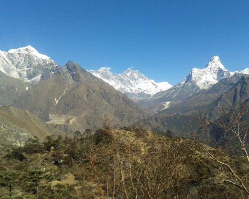
It is considered an ideal day for altitude acclimatization in this place. After breakfast, just go higher around the museum. There is a very nice viewpoint including the statue of Tenzing Norgay Sherpa and surrounding mountains such as Mt. Everest, Lhotse, Tawache, Nuptse, Amadablam, Thamserku, Kusumkangaru, Kwonge Peak, and Thame Peak. It would be the best morning ever in your travel time, then follow the steep climb up to the world’s highest airstrip airport, “Syangboche”. Turn right across the Everest View hotel to Khumjung village for a day excursion, visit the monastery which is still preserving a yeti’s head, then get back down to Namche by the side of the Khumjung school, or if you want to go to Khunde village, you can continue climbing and take a direct way to Namche bazaar from Khunde.

It is an easy flat trail until Sanasa through birch, pines, and fir trees with fine views of the mountains. From Sanasa, it climbs for one and a half hours up to Mongla Danda, then descends to Phortse Tanga. A well-known and typical ancient Sherpa village phrase is nicely visible along the way.  There is a heavy alpine forest of fir, rhododendron, birch, alpine bamboo, and pines between Phortse Tanga to Dole. The trail is scenic and mostly gradual uphill through the alpine forest. 6 hours

dole

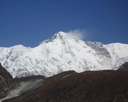
Scale up the way slowly to the ridge, from there you will see a giant mountain wall standing in the foreground is Mt.Cho Oyu, 8201m. The trail is not steady, however, it is gently ascending through Luza. Today, you will see a lot of yak pasture fields. In the former time, people from Khumjung, Kunde, and Phortse used to bring their animals into this valley thus still the land ownership is highly belonged to those people from the same village. Finally, we will arrive by clearing one hill lap to another into a Fish shaped valley in Machhermo village. 6 hours

gokyo

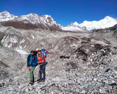
We have a short walk today. We will arrive at Gokyo by lunchtime. After lunch, we climb up the glacier edge for exploration. On the way, a little settlement called Fanga village appears. There was a big avalanche of devastation in 1996. The trail crosses the rocky, narrow hill near the glacier and turns around the valley towards the lake. There are many beautiful lakes in Gokyo Valley. Behind the lakes, there is a big glacier lying, which is spreading from the bottom of Mt. Cho–oyu. After walking slowly around the rocky corner, you will reach the third lake, where you will stay overnight at 4750m. 3 hours

You should start very early in the morning to climb up Gokyo Peak, 5380 Meters. This is known as the best viewpoint in the Khumbu region. You can see the panoramic view of Mt. Everest 8,848m, Lhotse 8,516m, Lhotse Shar 8,383m, Makalu 8,485m and Cho Oyu 8,201m and several other mountains such as Mt. Pumori (7161m), Ngozumba, Gyazungkhang, Tawatse, Cholatse, Mt. Changste (7550m), Mt. Lingterin (6679m), Mt. Amadablam (6856m), Bharuntse, Thamserku (6723m), Kantega( 6685m), etc. And a huge Ngozumba glacier and a fine view of the local Lakes. Descend to the lodge for breakfast, then leave your footprints and take memories back to Machhermo for overnight. 7 hours

Walking down via Luza, Lapharma, and Dole is quite comfortable. Also, it is quite easier to descend, make a day break at Phortse, and pass the Mongla danda then via a flat way to Namche bazaar for overnight. 6 hours. 

We meet so many trekkers today because most of the trekkers follow the same route until Namche Bazaar. Descending 600 m down to Dovan and a long zigzag trail via several Sherpa settlements to Lukla. Today we will have a farewell dinner together with every crew.

Take a morning domestic flight to Ramechhap and drive with a private vehicle back to Kathmandu, and free Noon time. 3 hours

Route Map
Gokyo Valley Trek in the Everest map
Cost Details

Note:

We offer every trip at an essential cost. We provide special discounts for larger groups, Travel Companies, Partner agents, student groups, and nonprofit Organizations.

We offer two kinds of packages, such as full package tours and service tours. Full package tours are inclusive of necessary transportation, staff wages, Staff insurance, permit fees, food, and all accommodations. On the service tours: clients have to make private payments for the food, transportation, and accommodation prices.

What's included
  • Airport pick up and drop off with a private vehicle
  • Deluxe Hotel Room on B/B Planning basis in Kathmandu (Before & after trekking)
  • Kathmandu - Ramechhap- Kathmandu drive with a private vehicle before and after trekking
  • Domestic plane ticket for both ways ( Ramechhap- Lukla- Ramechhap)
  • Plane ticket or transportation charge for your guide.
  • Trekking permit related to National park fees, TIMS, and Local permits.
  • Local accommodation and three times meals (Breakfast, lunch, Dinner) during the trek, including hot drinks.
  • Necessary Guide and Porters for your support on the trek
  • Guide's and porter's salary, including their trekking insurance, equipment, food, and accommodation.
  • sightseeing in Kathmandu (on your choice)
  • Service charges and farewell dinner
What's not included
  • Nepal entry visa
  • Your Travel insurance
  • Your personal expenses in Nepal
  • Your International airfare
  • Lunch and dinner during your stay in Kathmandu
  • Entrance fees at UNESCO's cultural world heritage vehicle and guide fees for site in Kathmandu
  • Tips for your trekking staff.
  • Your health insurance and expenses.
  • Helicopter price in case you need to be evacuated.
  • Your travel or trekking insurance
Useful Info

Domestic flights to and from Lukla

Note: Because of a heavy traffic jam at the International airport in Kathmandu and the necessity of several domestic flights to Lukla, flight operation was shifted to the nearest airport.

The Tribhuwan International Airport and the domestic Airport are partially the same in Kathmandu. Thus, it used to be heavy air traffic during international flights. The domestic flight schedule will often be interrupted by International flights.

The domestic flight to Lukla mostly departs early in the morning with small aircraft. The legendary Everest trek begins from Lukla, so most trekkers to the Everest region usually fly in and out from Lukla. Often, the higher volume of trekkers want to visit the Everest region. So, there should be several scheduled flights every day. Thus, Nepal Aviation had decided to operate smooth flights from the nearest airport to Kathmandu during the main trekking and peak season. The nearest airport is in the countryside called Manthali Ramechhap, which needs approximately 4 hours of off-road driving.

The flights are effective from the beginning of October to the End of November in autumn and March to mid-May in spring.

We recommend our clients move a day earlier from Kathmandu to nearby Manthali for the flight to Lukla. That will provide the perfect views of the countryside, also that will not be a rushed and uncomfortable drive.

Most trekkers get driven in the middle of the night from Kathmandu to Manthali for the next day’s morning flight. There would be some discomfort, such as less sleep that night, if you do not arrive on time at the airport, the flight can be missed. You never know what is happening and going on the road in the countryside.

Symptoms of altitude sickness

Altitude sickness (acute mountain sickness) is difficulty sleeping, dizziness, headache, fatigue, loss of appetite, rapid pulse, nausea, vomiting, etc. It affects mountain climbers, hikers, and skiers because of lower air pressure and lower oxygen levels. It occurs as a result of failure to adapt at a higher altitude. It happens most often in the brain or the lungs after the fluid begins to leak from the blood vessels.

When the fluid collects in the brain, you initially get headaches, loss of appetite, nausea, tiredness, a desire to lie down and feel powerless, physical movement is unwilling, and a decrease in consciousness, and the problem with balance coordination is called high–altitude cerebral edema (HACE). If the fluid is collected in the lungs, you become breathless and dry, and it causes a regular irritative cough, sometimes coughing up blood too, discoloration of the skin, and chest tightness is called high altitude pulmonary edema (HAPE).

Prevention of altitude Sickness

To prevent acute mountain sickness, we have to follow fundamental gravity habits such as patience, consistency, and discipline in the mountains. The mountains have their own rule and regulations. We cannot turn them into our nature except by following and respecting them. Cloth properly according to the altitude, avoid rapid altitude gain, drink enough water or fluid, take enough acclimatization time to adjust the body at a higher altitude, avoid alcoholic items, control smoking, eat regular meals, and get higher & sleep at lower altitudes. Avoid high altitudes if you have heart and lung disease. If the symptoms occur heavily, then stop detting altitude descend to a lower altitude.

In case the person is seriously sick or cannot bring him/her to a lower altitude by walking and carrying, then she/he should be rescued by a quick Helicopter evacuation.

Necessary Clothing for the Gokyo Valley trek

Lightweight walking boots, a pair of track shoes, and slippers to wear in the evening or when the boots are wet.

Warm jacket (Fibers fill or down should be adequate.)

A Rainproof jacket with a hood or poncho.

Warm clothes or fleece jackets.

Thin and thick trousers.

Warm trousers are useful higher up in the mountains in the morning and at night. (Windproof/ waterproof trousers are necessary during treks going above 3000 m)

Thermal underwear (These are excellent for sleeping at night)

A pair of loose-fitting long shorts and 1 lightweight long-sleeved shirt are particularly suitable for avoiding sunburn.

A woolen or warm hat to wear in the morning and at night. Sunhat and ensure it has a wide brim to cover the face and neck.

A pair of gloves (warm and normal ones)

2 pairs of thin and 2 pairs of thick warm socks.

Underwear, buff, and hankies as you need.

Accessories: Duffle bag or kit bag to carry your gear while trekking, sleeping bag. Small rucksack to carry personal requirements for the day, e.g., toilet paper, towel, soap, etc. Water bottle. Snow glasses and sunglasses, 2-4 large plastic bags to separate clean clothes from dirty ones. Headlamp with spare batteries, sun cream, personal medicine, lip guard, toothbrush, towel, Reading materials, game items (optional), notebook, rubber band, pen and pencil, a diary, a pocket knife, trekking map, passport, and copies.

Beware of drinking Water: Travelers should be very aware of drinking water in Nepal. They are not completely adapted to digest direct normal spring water due to bacteria. So, we recommend you drink mineral water or boiled water. Also, you can use some purifier tablets, such as chlorine tablets, for purifying water on the trek. We strongly recommend mineral water in the city area and purified or boiled water for the trek.

Accommodation System in the Gokyo Valley: We provide accommodation according to your demand and accessibility, either normal standards or comfortable luxury hotels in the City. We provide very neat, clean, and comfortable hotels, lodges, friendly homestays, or locally what is available accommodations for the most suitable on the trek. The dining room will be heated with firewood or yak dung in the center of the room.

Approximate walking hours per day: According to our itinerary, a minimum of 4 hours and a maximum of 10 hours of planning. But on the field, you need your own pace and rhythm, feel your condition, and adapt yourself to your comfort according to our guidelines.

Trail condition in the Gokyo Valley: The trail is often gradual ups and downs, rocky, with waterfalls, and streams, goes over several beautiful passes through the forests and alpine terrain, Lakes, glaciers, villages, several suspension bridges, yaks, mules, Chortens, Stupas, Gumbas, and prayer flags

Our Contact:

Mobile and WhatsApp: +977 9841265786 (Sanga)

Email: [email protected][email protected]

Similar Packages