Manasalu Circuit Trek - 15 DaysManasalu Circuit Trek - 15 Days

Manasalu Circuit Trek - 15 Days

2 reviews
  • Duration15 Days
  • DestinationNepal
  • Difficulty Strenuous
  • Max Altitude 5,160m
  • Activity Trekking and excursion
  • Group Size Minimum 2 pax
  • Accommodation Comfort hotel in KTM and local lodges on trekking
  • Meals Full package at trekking
  • Transportation Overland drive
  • Starts KTM- Machhakhola drive & trek
  • Ends Dharapani-KTM
  • Best Season Sep- Nov, March- May
Overview
Trip Highlights
  • Trekking with a special permit in a pristine landscape, rich in culture and genuine adventure, geographically spectacular and fascinating Tibetan Buddhist culture and tradition.
  • Unforgettable trekking experience for those seeking a challenging adventure, stunning Himalayan scenery, and a deep dive into local cultural Immersion. The Manaslu region is home to distinct ethnic groups, including Gurungs, Tamangs, and Tibetans. You'll experience their unique culture, traditions, and hospitality as you stay in local teahouses along the route.
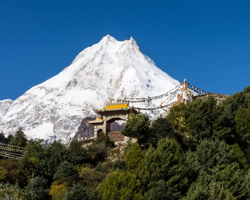
  • The massive view of the world’s eighth-highest Mt. Manaslu, 8,163m, Holistic site Pungkar Gomba, glacier, icefall, Lakes and Manaslu Base camp, and old monasteries, stupas, chortens, Lungdars, and yak pastures.
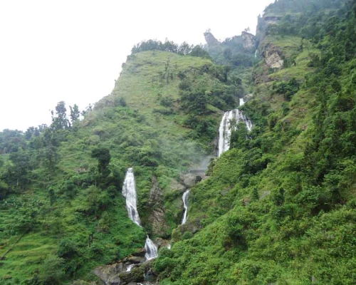
  • Diverse Landscapes: The trek takes you through a remarkable variety of terrain, from lush sub-tropical forests and terraced fields in the lower regions to high alpine pastures and glacial valleys. You'll cross numerous suspension bridges, follow the Budhi Gandaki River upstream, and pass through traditional Tibetan-influenced villages.
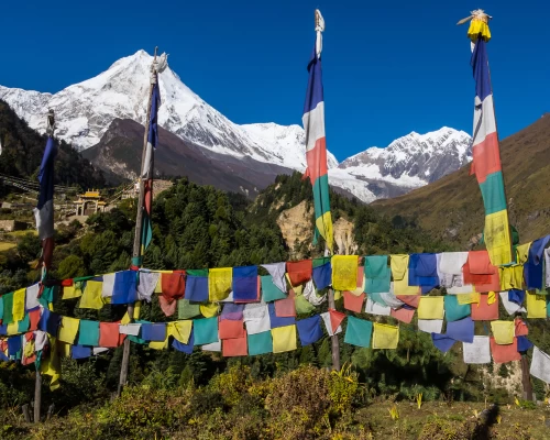
  • Stunning Mountain Views: The highlight for many is the breathtaking panorama of snow-capped peaks, including Manaslu, Himalchuli, Ngadi Chuli, Ganesh Himal, and the Annapurna range.
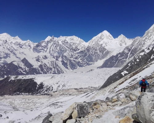
  • Larkya La Pass: The challenging Larkya La Pass, at an altitude of approximately 5,106m (16,752 ft) to 5,167m (16,952 ft), is the highest point of the trek and offers unparalleled views. It's often the most demanding section due to its altitude, rocky, and potentially snow-covered terrain.
  • Off-the-Beaten-Path: The Manaslu Circuit still feels like off-the-beaten-path, less crowded than some of the more established treks like the Annapurna Circuit or Everest Base Camp, offering a more serene and authentic Himalayan experience.
  • The Manaslu Circuit trek is generally considered a remote and strenuous, moderately challenging trek through demanding terrain.


manasalucons

Manaslu Circuit Trekking has been open only since 1991 for outsider travelers. This trek is a unique opportunity to experience and explore Pristine Mountain View, rich culture, and genuine adventure sum around the "untouched" region of Nepal. Mt. Manaslu 8,163m tall is one of the most beautiful mountains in Nepal. Manaslu is derived from the Sanscrit word “MANASA” which is translated as the mountain spirit. The trek begins from the old, independent kingdom of Gorkha to the Budi Gandaki valley. Distinctively people are Buddhist and their links are transmitted from Tibetan tradition. The flat-roofed houses boast Monasteries with embossed prayer wheels and Chortents guarding the entrances of towns. The Tibetan monks inhabiting sacred monasteries give the joy of Tibetan feeling and spirituality. This area offers a combination of cultural heritage, unsurpassed beauty, and biological diversity. The Manaslu was climbed in 1956 for the first time by Japanese alpinist. The trek is relatively enriched by flora and fauna, ascending and descending through the alpine forest, Himalayan villages, and landscapes comes to join at Dharapni the main classic trail to Annapurna Circuit route then ending throughout Besisahar by overland drive.

Itinerary

KTM-MaxakholaWe start overland driving along the Prithvi highway till Anbu Khaireni and turn towards Dhading Besi or Gorkah road by seeing the wonderful views of picturesque landscapes, mountains, villages, terraced fields, and lifestyle of different ethnic groups. Lunch break will be somewhere along the road in a good restaurant, who mostly serves  Nepalese famous Daal bhat. The road prevail rough tough everywhere in Nepal so the most bumpier road starts onwards Arughat Bazaar.

Maxakhola-Jagat

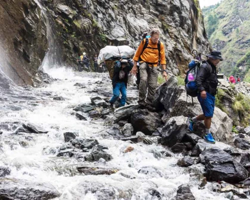
The trek frequently follows the rough road along the Gandaki River bank. It does not prevail a big ascend and descend. However, the path is always full of upward and downward walking. Frequently groups of Mules who are doing goods delivery will be encountered along the path. We strongly recommend you stay on the wall side for safety at narrow passes in the mountains whenever you get crossed with animals.

The trek becomes simply the best from today. The trail continuously follows the Gandaki River bank. Today you will see the first view of Mt. Singhi and Ganesh Himal. The landscape, nature, cultural life and tradition, and a glimpse of different crops and animals make your trekking like a deep meditation. Lunch break will be in Chisopani and continue walking to the camp. On the way, you will meet a waypoint that segregates the trail right to the Tsum Valley trekking and left to the Rupinala trekking. You keep always towards the River bank ahead to Pewa. Pewa is not a big village there are only 2 tea houses but a very silent and simple overnight passage.

In the beginning, the trek leads you upwards to Deng village and via Rana village to the other side of the River. Today the trail is narrower than other day's also a slightly dangerous cliff and rock falling but it is a very beautiful walk. You will have a first view of Mt. Manaslu cap today, lunch will be around in Bhi Pedhi, a Buddhist shrine, and symbols prevail more from today. 

ghap

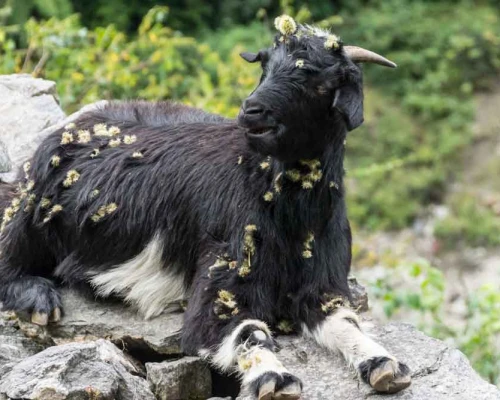
It will be like a meditational walk through the Himalayan forest. Sometimes you meet a group of Himalayan white Languor in the forest. Domestic animals like yak, Chauri, horses, cows, goats, sheep, and mules are available all around here. Also, some Himalayan wild animals are visible on the way. The trail does not climb directly but gradually and long ascends via Lihi village. On the way you will frequently see so many different attractive Buddhist traditions; finally, you will arrive at the Lho (a mind-blowing view place). There is a very beautiful monastery so if you arrive on time then make an evening monastery visit during puja otherwise visit the next day during passing towards Samagau trekking. Make an earlier wake up the next day to see the Golden sunrise on Mt. Manaslu, probably the best photos of Manaslu will be from the Lho.

Ghap-Lho

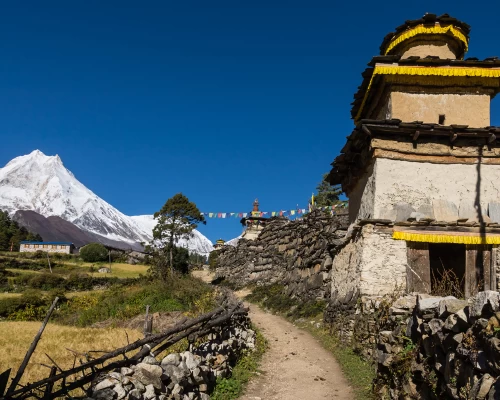
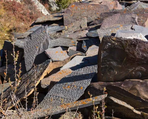
Walking through the forest leads you up to the Shyala village. This village offers you wonderful rounding mountain views. We make tea breaks here for some hours to enjoy the panoramic mountain scenery. 1 hour of easy walking brings you to the central and major town of Samagaun. This village has very unique beauties of Buddhist culture, way of life, monasteries, Mani walls, and Stupas. You will arrive in Samagaun by lunchtime and make a private free walk all around the village.

Lho Village
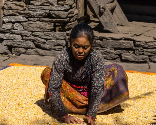
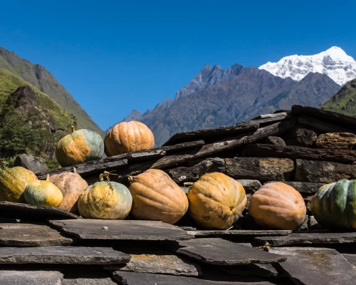
Harvesting time at Lho village (3520 Meters above the Sea Level )


There are two options for acclimatization in Samagaun (1) visiting pungent gomba. (2) Is visiting Manaslu basecamp with Birendra Taal.  I recommend Pungen Gomba: take a packed lunch and make a Pungen Gompa visit. Pungen Gompa is a famous deity in this region. This Deity is believed as the ruler of good or bad weather/ fortune or spirit and Manaslu means the peak of spirit or soul. It may take 3 hours of climbing up to the bottom of the Mt Manaslu glacier. When you get up to the temple at Glacier. The surrounding Circumstances, views, glacier, ice fall, blue sheep, yaks, a monastery, a stupa, rocks, and a glance of avalanches will make it like a paradise hiking.  You will arrive at the camp by 3 PM and then get free time with tea and a hot shower. 

Samdo Villlage
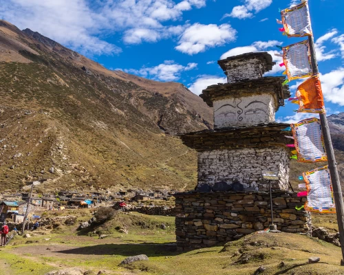
Samdo and Samagaun Village View from Samdo Hill.

The trek starts after breakfast. Make a short visit to the oldest monastery by the side of the trail and then keep walking along the legendary way with full panoramic views of the mountain. The trail is easy to inflate along the Sama Valley, Himalayan pine, birch, bamboo, rhododendron, and fir forest making nature a wonderful sight. You will arrive at Samdo by lunch time and make some hours of climbing up to Samdo ri for better acclimatization. Getting at higher and sleeping at lower places should be applied. Samdo provides very simple lodges than Samagaun however you get very good and fine sleeping rooms. 

Your trek begins after lunch. The destination is not far but due to the altitude, it takes a longer time. The trail climbs gradually up head with fantastic views of Manaslu north, Larke Peak, Samdo Peak, etc….. Food and rooms in Dharmasala are very simple and basic standards, sometimes we must sleep in a dormitory room with several other people. You arrive at the camp by the lunch and again make a hiking up to the Dharmasala ri for height gain.

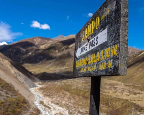
You have to start your trek around 3:00 AM due to the wind. If you arrive late at the pass then it is very windy so most of the trekkers begin earlier. The trail is not strongly steep but gradually upwards and very long to the pass. After the pass, it descends to the Manang Valley with mind-blowing views of different mountains. It is quite an enjoyable trail to descend however takes a very long time to get to Bhimtang. The destination seems closer however it is quite long and tough walking until you arrive at the place. The hotel offers a very nice and clean room with a very comfortable warm dining hall.

larkepass

Today the scenery and landscape are also quite beautiful, this valley or trekking reminds you of the European Alps trekking except for the high mountain views. The trail descends always downwards to the beautiful place via beautiful landscape and Tibetan-looking villages to the Dharapani.  Dharapani is a point you meet for the legendary Annapurna Circuit trail. Overnight at very nice hotels with fantastic hot showers and food.

bhimtang

Take a local jeep from Dharapani to Besisahar and then drive back to Kathmandu by private vehicle along to classic road to Pokhara.

Route Map
Manasalu Circuit Trek - 15 Days map
Cost Details

The cost of this trip based on accommodation in the city, group size, transportation usage, and level of services. We provide special discounts for larger group, relevant travel companies, partners or agents, and non-profit organizations.

We offer this trip on the best price of our cleits, just mention to us your group size, expecting services on trekking, and accommodation standards in the city.

What's included
  • Airport pick up, greetings, and Farewell.
  • 2 nights' comfort Hotel room on B/B planning in Kathmandu before the trip.
  • Sightseeing vehicle and a guide for the world heritage site in Kathmandu.
  • Kathmandu to Sotikhola private 4-wheeler jeep drop.
  • 3 times food (breakfast, lunch, dinner) and hot drinks like Tea and coffee during trekking.
  • Good Hotel or lodge accommodation during the trek.
  • Special Manasalu restricted permit,
  • TIMS permit
  • Annapurna Conservation Permit.
  • Service charge and Trekking insurance charge for your crews.
  • 1 guide and necessary staff and porters for Manasalu circuite trip
  •  4X4 wheel vehicle from Dharapani to Besishahar and private vehicle to KTM
  • 1 night Hotel room on B/B planning in KTM
  • First aid medicine and materials
  • Transportations cost for your staff
  • Farewell dinner at the end
  • Airport delivery car by the time of departure
What's not included
  • All kinds of your personal and medical expenses
  • Your travel insurance and Nepal visa fee.
  • Your trekking equipment.
  • All kinds of beverages like: mineral water, alcoholic or nonalcoholic bottled drinks, canned drinks, and boiled water for your bottle.
  • Your entrance fee at the Temple, monastery, or the world heritage sites
  • Your International airfare
  • Tips for your trekking staff
  • Your additional room charge in the city in case you stay longer than our program
  • Helicopter charter price in case a quick evacuation is needed
Departure Dates
Select a Departure Month
Trip DatePriceAvailabilitySpace Left 
Trip DateSep 25, 2025 - Oct 09, 2025PriceUS$1650StatusAvailableSpace Left
Useful Info

Manaslu Circuit Trek Permit Cost Details:

Best Time to Trek:

Spring ( March May): consider the best times for Manasalu Circuit trek, it Offers pleasant temperatures, blooming rhododendron forests, and clear mornings.

Autumn ( Sep- November): Provides stable weather, crisp air, and stunning visibility of snow-capped peaks after the monsoon. October is often cited as the peak month for trekking in Nepal, offering ideal conditions.

Monsoon (June to August): Brings heavy rainfall, making trails slippery and views obscured.

Winter (December to February): is very cold, with snow at higher altitudes, and some teahouses may be closed, making the Larkya La Pass crossing particularly challenging and potentially requiring specialized gear

1. Manaslu Restricted Permit Fee: 

Manaslu trek permit from September to November (autumn) will cost USD 100 for the first seven days and USD 15 for each additional days Manaslu trek permit from December to August (winter, spring, and summer) will cost USD 75 for the first seven days and USD 10 for each additional days

2. Manaslu Conservation Area Permit Fee: 

MCAP Entry Fee for SAARC: NRs.1000 per person
MCAP Entry Fee for other nationals: NRs. 3000 per person

3. Annapurna Conservation Area Permit Fee (ACAP): 

ACAP Entry Fee for SAARC: NRs. 1000 per person
ACAP Entry Fee for other nationals: NRs. 3000 per person

If you choose Tsum Valley as a side-trip, then you need to add one more permits – Tsum Valley permit. It will cost USD 40 per person for one week.

Whereas, you can also continue Annapurna Circuit Trek or Annapurna base camp route. You need to apply for the TIMS card. It will cost USD 30 per person.

Manaslu Trekking Permits Terms and Conditions:

  • For children under 10 years of age, no need to apply for permits
  • Trekkers need permits for MCAP and ACAP
  • An entry permit is non-refundable as well as non-transferable and valid for the single entry only
  • The person entering the Conservation Area shall abide by the National Park and Wildlife Conservation Act, 2029 B.S. (1973) and the Regulations made under this Act
  • Entry Permits will not be issued from any check posts along the trekking routes of the Conservation Areas. It is only available from Kathmandu and Pokhara tourism board office
  • Entry permits must be carried during the entire trek and should be shown in checkpoint
  • Above Manaslu trek, permit cost include 13% Value Added Tax (VAT) and all other government taxes

Clothing Equipment

Lightweight walking boots, a pair of track shoes and slippers to wear in the camp at evening or when the boots are wet.

  • Warm jacket (Fibers fill or down should be adequate.)
  • A Rainproof jacket with a hood or poncho.
  • Woolen shirts and thick sweaters, or fleece jackets.
  • Thin and thick trousers.
  • Heavyweight trousers are useful higher up in the mountains in the morning and at night. Windproof/ waterproof trousers are necessary during treks going above 3000 m.
  • Thermal underwear (This is excellent for sleeping at night)
  • A tracksuit for wearing in camp. 2 pairs of loose-fitting long shorts/ skirts. 1 lightweight long-sleeved shirt is particularly suitable for avoiding sunburn.
  • A woolen or warm hat to wear in the morning and at night. Sunhat and ensure it has a wide brim to cover the face and neck.
  • A pair of gloves (warm and normal ones)
  • 2 pairs of thin and 2 pairs of thick warm socks, Underwear, a buff, and handkerchiefs as you need.
  • Necessary personal items if you are a woman.

Accessories

A duffle bag or kit bag to carry to gear while trekking, and a sleeping bag. Small rucksack to carry personal requirements for the day, e.g., toilet paper, camera, film, towel, soap, etc. Water bottle. Snow glasses and sunglasses, 2-4 large plastic bags to separate clean clothes from dirty ones. Headlamp with spare batteries, Snow gaiters, sun cream, personal medicine, lip guard, tooth brush, towel, Reading materials, camera and film, game items (optional), notebook, rubber band, pen and pencil, a diary, a pocket knife, trekking map, passport and copies.

Altitude sickness

Altitude sickness (acute mountain sickness) is difficulty sleeping, dizziness, headache, fatigue, loss of appetite, rapid pulse, nausea and vomiting, etc. It affects mountain climbers, hikers, and skiers is caused by lower air pressure and lower oxygen levels. It occurs as the result of failure to adapt to a higher altitude. It happens most often in the brain or in the lungs after the fluid begins to leak from the blood vessels.

1, High–altitude cerebral edema (HACE): When the fluid collects in the brain, you initially get a headache, loss of appetite, nausea, tiredness, a desire to lie down and do nothing, a decrease in consciousness, problems with balance and coordination.

2. High-altitude pulmonary edema (HAPE). If fluid collects in the lungs, you become breathless, a dry and irritating cough begins, coughing up blood, discoloration of the skin, and chest tightness.

Prevention

To prevent an acute mountain sickness, we have to avoid rapid altitude gain, drink enough water or fluid, acclimate to adjust the body to higher altitudes, avoid alcohol, eat regular meals, get higher and sleep at a lower altitude, and avoid high altitude if you have heart and lung disease. The main treatment for acute mountain sickness is to stop climbing and descend to a lower altitude. Use the proper altitude medicine that is prescribed by your doctor.

Drinking Water

You should drink a minimum of 3 liters of water per day at an altitude. You can buy Mineral water or fill a water bottle by filtering the water or from the Hotel kitchen.

Walking hours

It depends on yourself or your physical condition. Our Itinerary is made on average of 4 hours - 7 hours per day, and a Maximum of 10 hours for the Larke Pass.

TestimonialsWhat our Traveler say
Similar Packages