Tsum Valley Manaslu Circuit TrekkingTsum Valley Manaslu Circuit Trekking

Tsum Valley Manaslu Circuit Trek - 21 Days

  • Duration23 Days
  • DestinationNepal
  • Difficulty Strenuous
  • Max Altitude 5,160m
  • Activity Trekking and excursion
  • Group Size min. 2
  • Accommodation Comfortable hotel in KTM and local lodges on trekking
  • Meals Full package at trekking
  • Transportation Overland drive
  • Starts KTM- Machhakhola & treks
  • Ends Dharapani
  • Best Season Sep- Nov, March- May
Overview
Trip Highlights
  • Combining the Tsum Valley trek with the Manaslu Circuit offers a truly immersive and extended, unique and unforgettable adventure into a remote and culturally rich part of the Nepalese Himalayas.
  • The hidden land with historical caves where Guru Rimpoche and Milarepa visited for Meditation it has exclusive Tibetan customs, picturesque villages, traditional houses, Buddhist Mani walls, ancient monasteries, and a beautiful Nunnery Monastery.
  • The Tsum Valley Trek is a captivating journey into a remote, culturally rich, and spiritually significant region of Nepal.
  • Tsum means “Hidden or Isolated valley" in the Tibetan language. It is known as a Buddhist Beyul land, a sacred and peaceful place or sanctuary.
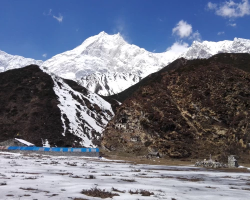
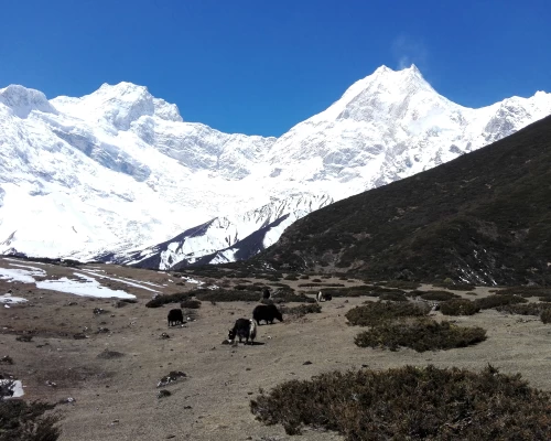
  • Very nice views of holy Mt. Ganesh Himal, Siringi Himal, Himalchuli, and Boudha Himal. The massive view of the world’s eighth-highest Mt. Manaslu, 8,163m, and the Holistic site Pungkar Gomba, glacier, icefall, Lakes and Manaslu Base camp.
  • This trek typically starts by exploring the hidden Tsum Valley, known for its unique Tibetan Buddhist culture, ancient monasteries, and pristine landscapes, before joining the classic Manaslu Circuit route.
  • Solo trekking is generally not allowed in these regions, only guided tours with a minimum of 2 people
  • Trekking starts: The trek usually begins with a drive from Kathmandu to Machhakhola.
  • Tsum Valley Section: exploring Chumling, Chhokangparo, Nile, and reaching high points like Mu Gompa. This section allows for deeper cultural immersion and exploration of ancient Buddhist sites like Rachen Gompa and Milarepa's Cave.
  • Manaslu Circuit Section: After rejoining the main Manaslu trail, the trek continues through villages Deng, Namrung, Lho, Samagaun, and Samdo, gradually gaining altitude.
  • Larkya La Pass: The Manaslu Circuit crosses the challenging Larkya La Pass (5,106m), offering breathtaking panoramic views of surrounding peaks.
  • Trekking ending: After the pass, the trail descends through Bimthang, Tilje, and Dharapani, eventually connecting with the Annapurna Circuit trail at Dharapani

Tsum Valley

Tsum Valley and Manaslu trek is the most astonishing in remote pristine areas. Tsum Valley and Manaslu Trek is a journey on the quiet and quaint trails of the Himalayas. Both regions are opened for travelers just some years back so that the culture and traditions are still uninfluenced by outsiders. Major attractions of Tsum Valley are Milarepa’s cave, sacred cave, Buddhist paintings, a nunnery Gomba (Rachen Gompa) the largest regional Mu Gompa, and Gumba Lungdang. Trekking in Tsum (holistic, historic, and scenic) Valley allows you to understand the depth practices of Tibetan Buddhism and connect to the Mt. Manaslu (the 8th highest mountain in the world) that provides the thrilling adventurous experience of the high mountains.

The Tsum Valley and Manaslu trekking trail passes many ascending and descending, over the ridges and villages along the Budhi Gandaki River bank.The trail ascends through several villages of different ethnicities with a ravishing view of the Manaslu range with other surrounding panoramic Himalayas. One of the most highlighted thing is walking through Larkya Glacier to cross the longest mountain pass in Nepal Larkya-La (5160m). The trail then descends to the most beautiful highland pastoral settlement Bhimtang and follows the trails of the Marshyangdi River to the trekking ending point of Dharapani village.

Itinerary

We start overland driving along the Prithvi highway till Anbu Khaireni and turn towards Dhading Besi or Gorkah road by seeing the wonderful views of picturesque landscapes, mountains, villages, terraced fields, and different cultures of different ethnic groups. Lunch break will be somewhere in a good restaurant, you can try Nepalese famous daal bhat today. The rough and bumpy road starts from Arughat Bazaar to Sotikhola. Overnight at a local tea house.


machhakholaThe trek frequently follows the Gandaki River bank. Not a big ascends and descends prevail here, however, the path is always full of up and down. Frequently goods delivery groups of mules will be encountered along the path. By then please be safe yourself towards the wall side not to the edge.

Today we enter the constrained region of Manaslu and Tsum Valley. Leaving Jagat, we start walking on the riverbank of Budhi Gandaki past the settlements of Salleri, Sirdibas, and Philim. Enjoying the view of Shringi Himal (7161m), we register ourselves at the checkpoint in Philim before heading on to Ekle Bhatti. Still walking alongside the Budhi Gandaki River, we arrive at a waterfall before entering the village of Lokpa. Overnight at a lodge in Lokpa

lokpa

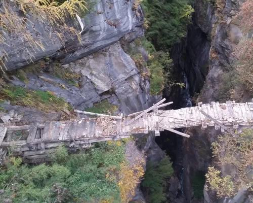
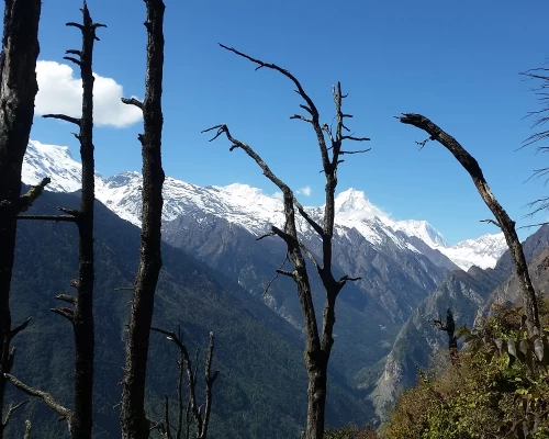
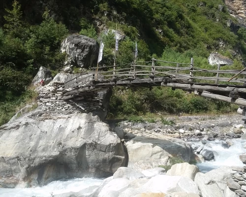
Descend through beautiful forest, crossing three side streams (one shown wrongly on the Map as Shiar Khola) on bridges, circle under a huge bluff on the river then climb steeply on well-made but exposed stairs. After about 30mins start to traverse north through pines and rhododendrons, still climbing and with very steep slopes. The hidden valley of Tsum stretches enticingly ahead. Eventually, descend to a lone Bhatti Ghumlong (2130m) on the river. The path straight ahead climbs steeply to Ripchet (2470m; Ripche) in about 1hr; the path to Chumling (2360m) crosses the Shiar Khola on a wooden bridge and up. It is not for those afraid of heights - several locals have fallen to their death on this track while drunk. Make sure you climb up to Chumling and check out the old gompa, the traditional houses, orchards, the clinic, and the beautiful stone streets. This is Buddhist agriculture, with conical pine needle haystacks among the 4 prayer flags. Overnight at a lodge in Chumling. 

chumling

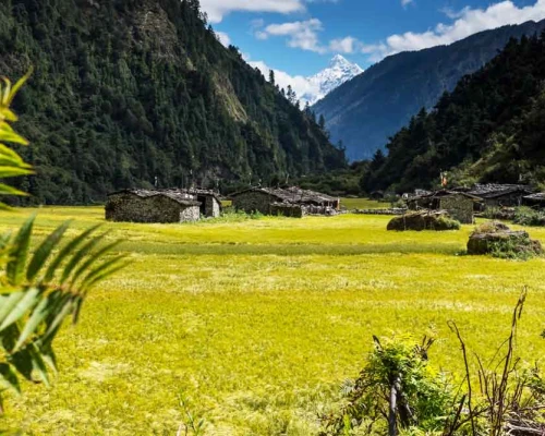
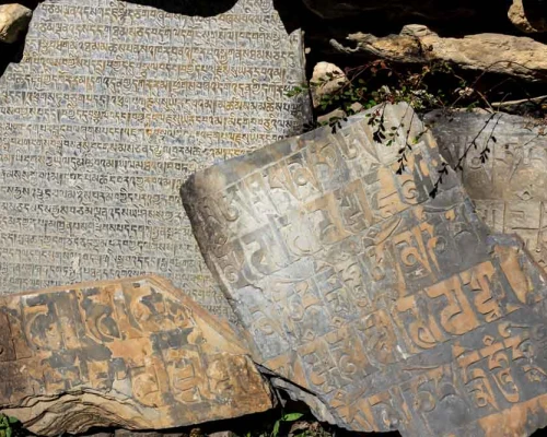
The trail is lined with artistic chortens and mani walls made of thousands of stone slabs carved with deities and prayers. An easier day after yesterday, Cross the suspension bridge just east of the hotel and traverse through the rich farming land of maize and potatoes. The houses are classic Tibetan with barricades of firewood on the roof, but without flat roofs, as it rains and snows here. Cross a huge slip where rocks and flood cleared the area even up onto the opposite bank, killing five in 1999, but is now covered with a forest of new trees. Up the valley to the east are superb views of the 7000m Ganesh Himal, of long suspension bridges on the opposite bank, and far above the perched village of Ripchet (2468m). Lunch is possible at Rainjham (2400m), a single bhatti with an enclosed courtyard. Cross the Serpu Khola and climb for 2.5 hours on a well-graded but exposed track to upper Tsum and the large village of Chhokangparo (3010m), stone houses nestled under cliffs without a single iron roof. The valley opens here into spacious fields of barley, maize, buckwheat, and potato, but wheat has been abandoned due to ‘hill bunt’, a disease which turns the heads black and causes total crop failure. Herds of Thar often graze the wild cliffs to the north, coming right down to the fields. If the air is clear Himalchuli (7893m) can be seen down the valley. Overnight at a lodge in Chhokangparo.

chhokangparo

Today we trek uphill alongside Shiar Khola to arrive at the nunnery of Rachen Gompa, which is an ancient nunnery of Tsum Valley. Enjoying the attractive views of the valley, we arrive at Piren Phu/Milarepa cave. Piren Phu is one of the holiest caves in the Tsum Valley. Ancient Buddhist paintings, excellent creative scripts carved on stones, long prayer flags, and important Buddhist scripts make this cave one of the most significant socio-cultural assets of the valley. We continue climbing up until we arrive at a beautiful village Nile. 

mugompa

Leave your rucksack at the Nile, Make an early climb up to the large Mu Gompa (3700m) with rows of chortens and widening mountain vistas. This is the largest monastery with over 100 monks and an ancient gompa. If time permits you can also visit Dhephyudoma Gompa (4000m) further west on an obvious track. On three sides now are tantalizing views of the border with Tibet, with frequently used passes to the east (Ngula Dhojyang or Mailatasachin Pass, 5093m) and west (Thapla Bhanjyang, 5104m) just out of sight. Some people climb to Kalung (3820m). Making a day trip to the passes for a view into Tibet. There are extensive seasonal yak pastures in all directions, the Lungdang Glacier to the east, and high peaks in all directions. 

Returning down to the same way you came through via Phurbe village, but stay on the east bank of the Shiar Khola and cross flat boulder-covered plains to Rachen Gompa (3240m), where it is possible to inspect the ancient gompa. The older part of the nunnery is more interesting Gomba than the others. Most of the families in the Tsum practice at least one member is either Nun or Monk at the monastery. Keep walking down to the south until a bridge crosses to the west bank then descend again to Chhokangparo village. Overnight at a lodge in Chhokangparo.

Move downhill on a narrow track via the village and to a wooden bridge over Shiar Khola. Cross the bridge to reach Domje and avoid the trail to the left side, that goes to the Ganesh Himal Base Camp. Descend down to the same way you came up via Chumling, Lokpa  and cross the suspension bridge over the Budhi Gandaki River and leave Lokpa to enter Nyak Phedi. Then continue walking uphill on the gorge of Budhi Gandaki River till Pewa. Overnight at local lodge.


ghapGradually climbing up to the Deng villages and follow a long River gorge path throung forest and beautiful landscape. We cross Mani walls and several bridges over the Budhi Gandaki River and finally arrive in Ghap village.

It will be like a meditational walk through the Himalayan forest. Sometimes you meet a group of Himalayan white Languor in the forest. Domestic animals like yak, Chauri, horses, cows, goats, sheep, and mules are available all around here. Also, some Himalayan wild animals are visible on the way. The trail does not climb directly but gradually and long ascends via Lihi village. On the way you will frequently see so many different attractive Buddhist traditions; finally, you will arrive at the Lho (a mind-blowing view place). There is a very beautiful monastery so if you arrive on time then make an evening monastery visit during puja otherwise visit the next day during passing towards Samagau trekking. Make an earlier wake up the next day to see the Golden sunrise on Mt. Manaslu, probably the best photos of Manaslu will be from the Lho.

ghap

Walking through the forest leads you up to the Shyala village. This village offers you wonderful rounding mountain views. We make tea breaks here for some hours to enjoy the panoramic mountain scenery. 1 hour of easy walking brings you to the central and major town of Samagaun. This village has very unique beauties of Buddhist culture, way of life, monasteries, Mani walls, and Stupas. You will arrive in Samagaun by lunchtime and make a private free walk all around the village.

There are two options for acclimatization in Samagaun (1) visiting pungen gomba. (2) Is visiting Manaslu basecamp with Birendra Taal.  I recommend Pungen Gomba: take a packed lunch and make a Pungen Gompa visit. Pungen Gompa is a famous deity in this region. This Deity is believed as the ruler of good or bad weather/ fortune or spirit and Manaslu means the peak of spirit or soul. It may take 3 hours of climbing up to the bottom of the Mt Manaslu glacier. When you get up to the temple at Glacier. The surrounding Circumstances, views, glaciers, ice fall, blue sheep, yaks, a monastery, stupa, rocks, and a glance of avalanches will make it like a paradise hiking.  You will arrive at the camp by 3 PM and then get free time with tea and a hot shower. 

samagaun

The trek starts after breakfast. Make a short visit to the oldest monastery by the side of the trail and then keep walking along the legendary way with full panoramic views of the mountain. The trail is easy to inflate along the Sama Valley, Himalayan pine, birch, bamboo, rhododendron, and fir forest making nature a wonderful sight. You will arrive at Samdo by lunch time and make some hours of climbing up to Samdo ri for better acclimatization. Getting at higher and sleeping at lower places should be applied. Samdo provides very simple lodges than Samagaun however you get very good and fine sleeping rooms. 

samdo

Your trek begins after lunch. The destination is not far but due to the altitude, it takes a longer time. The trail climbs gradually up head with fantastic views of Manaslu north, Larke Peak, Samdo Peak, etc….. Food and rooms in Dharmasala are very simple and basic standards, sometimes we must sleep in a dormitory room with several other people. You arrive at the camp by lunch and again make a hiking up to the Dharmasala ri for height gain.


larkepassYou have to start your trek around 3:00 AM due to the wind. If you arrive late at the pass then it is very windy so most of the trekkers begin earlier. The trail is not strongly steep but gradually upwards and very long to the pass. After the pass, it descends to the Manang Valley with mind-blowing views of different mountains. It is quite an enjoyable trail to descend however takes a very long time to get to Bhimtang. The destination seems closer however it is quite long and tough walking until you arrive at the place. The hotel offers a very nice and clean room with a very comfortable warm dining hall.

bhimtang

Today the scenery and landscape are also quite beautiful, this valley or trekking reminds you of the European Alps trekking except for the high mountain views. The trail descends always downwards to the beautiful place via beautiful landscape and Tibetan-looking villages to the Dharapani.  Dharapani is a point you meet for the legendary Annapurna Circuit trail. Overnight at very nice hotels with fantastic hot showers and food.

Take a local jeep from Dharapani to Besisahar and then drive back to Kathmandu by private vehicle along to classic road to Pokhara.

Route Map
Tsum Valley Manaslu Circuit Trek - 21 Days map
Cost Details

The cost of this trip based on accommodation in the city, group size, transportation usage, and level of services. We provide special discounts for larger group, relevant travel companies, partners or agents, and non-profit organizations.

We offer this trip on the best price of our cleitns, just mention to us your group size, expecting services on trekking, and accommodation standards in the city.

What's included
  • Airport pick up, greetings, and Farewell.
  • 2 nights' comfort Hotel room on B/B planning in Kathmandu before the trip.
  • Sightseeing vehicle and a guide for the world heritage site in Kathmandu.
  • Kathmandu to Sotikhola private 4-wheeler jeep drop.
  • 3 times food (breakfast, lunch, dinner) and hot drinks like Tea and coffee during trekking.
  • Good Hotel or lodge accommodation during the trek.
  • Special restricted permits for Tsum and Manasalu circuite
  • TIMS permit
  • Annapurna Conservation Permit.
  • Service charge and Trekking insurance charge for your crews.
  • 1 guide and necessary staff and porters for Manasalu circuite trip
  •  4X4 wheel vehicle from Dharapani to Besishahar and private vehicle to KTM
  • 1 night Hotel room on B/B planning in KTM
  • First aid medicine and materials
  • Transportations cost for your staff
  • Farewell dinner at the end
  • Airport delivery car by the time of departure
What's not included
  • All kinds of your personal and medical expenses
  • Your travel insurance and Nepal visa fee.
  • Your trekking equipment.
  • All kinds of beverages like: mineral water, alcoholic or nonalcoholic bottled drinks, canned drinks, and boiled water for your bottle.
  • Your entrance fee at the Temple, monastery, or the world heritage sites
  • Your International airfare
  • Tips for your trekking staff
  • Your additional room charge in the city in case you stay longer than our program
  • Helicopter charter price in case a quick evacuation is needed
Useful Info

Tsum valley Manaslu Circuit Trek Permit Details:

Since you're combining two restricted areas, you'll need multiple permits. These permits typically need to be arranged through a registered trekking agency.

Manaslu Restricted Area Permit (MRAP): This is mandatory for trekking in the restricted areas of Manaslu. The cost varies by season and duration.

September to November: USD 100 per person for the first week, then USD 15 per person per day.

December to August: USD 75 per person for the first week, then USD 10 per person per day.

Tsum Valley Restricted Area Permit (RAP): Required to enter the Tsum Valley.

September to November: USD 40 per person per week, then USD 7 per person per day.

December to August: USD 30 per person per week, then USD 7 per person per day.

Manaslu Conservation Area Project (MCAP) Permit: Required to enter the Manaslu Conservation Area. The fee is around USD 23-30 per person.

Annapurna Conservation Area Permit (ACAP): Since the Manaslu Circuit trek exits into the Annapurna Conservation Area (from Dharapani), this permit is also required (approx. USD 30 per person).

Chumnubri Rural Municipality Permit: This local permit Rs. 1000 per person, is required

Clothing Equipment

Lightweight walking boots, a pair of track shoes and slippers to wear in the camp at evening or when the boots are wet.

  • Warm jacket (Fibers fill or down should be adequate.)
  • A Rainproof jacket with a hood or poncho.
  • Woolen shirts and thick sweaters, or fleece jackets.
  • Thin and thick trousers.
  • Heavyweight trousers are useful higher up in the mountains in the morning and at night. Windproof/ waterproof trousers are necessary during treks going above 3000 m.
  • Thermal underwear (This is excellent for sleeping at night)
  • A tracksuit for wearing in camp. 2 pairs of loose-fitting long shorts/ skirts. 1 lightweight long-sleeved shirt is particularly suitable for avoiding sunburn.
  • A woolen or warm hat to wear in the morning and at night. Sunhat and ensure it has a wide brim to cover the face and neck.
  • A pair of gloves (warm and normal ones)
  • 2 pairs of thin and 2 pairs of thick warm socks, Underwear, a buff, and handkerchiefs as you need.
  • Necessary personal items if you are a woman.

Accessories

A duffle bag or kit bag to carry to gear while trekking, and a sleeping bag. Small rucksack to carry personal requirements for the day, e.g., toilet paper, camera, film, towel, soap, etc. Water bottle. Snow glasses and sunglasses, 2-4 large plastic bags to separate clean clothes from dirty ones. Headlamp with spare batteries, Snow gaiters, sun cream, personal medicine, lip guard, tooth brush, towel, Reading materials, camera and film, game items (optional), notebook, rubber band, pen and pencil, a diary, a pocket knife, trekking map, passport and copies.

High Altitude: You'll be spending over two weeks in mountain regions, with elevations exceeding 3,000 meters and twice above 5,000 meters. Proper acclimatization days build crucial to minimize the risk of altitude sickness.

Altitude sickness

Altitude sickness (acute mountain sickness) is difficulty sleeping, dizziness, headache, fatigue, loss of appetite, rapid pulse, nausea and vomiting, etc. It affects mountain climbers, hikers, and skiers is caused by lower air pressure and lower oxygen levels. It occurs as the result of failure to adapt to a higher altitude. It happens most often in the brain or in the lungs after the fluid begins to leak from the blood vessels.

1, High–altitude cerebral edema (HACE): When the fluid collects in the brain, you initially get a headache, loss of appetite, nausea, tiredness, a desire to lie down and do nothing, a decrease in consciousness, problems with balance and coordination.

2. High-altitude pulmonary edema (HAPE). If fluid collects in the lungs, you become breathless, a dry and irritating cough begins, coughing up blood, discoloration of the skin, and chest tightness.

Prevention

To prevent an acute mountain sickness, we have to avoid rapid altitude gain, drink enough water or fluid, acclimate to adjust the body to higher altitudes, avoid alcohol, eat regular meals, get higher and sleep at a lower altitude, and avoid high altitude if you have heart and lung disease. The main treatment for acute mountain sickness is to stop climbing and descend to a lower altitude. Use the proper altitude medicine that is prescribed by your doctor.

Drinking Water: You should drink a minimum of 3 liters of water per day at an altitude. You can buy Mineral water or fill a water bottle by filtering the water or from the Hotel kitchen.

Walking hours: It depends on yourself or your physical condition. Our Itinerary is made on average of 4 hours - 7 hours per day, and a Maximum of 10 hours for the Larke Pass.

Strenuous: This combined trek is considered strenuous due to its long duration, high altitude, remote nature, and the need to cover significant distances daily.

Remote Terrain: The trails are often narrow, with steep ascents and descents, and lodging facilities and food facilities are normal, especially in the Tsum Valley side.

Accomodation: We use comfortable and clean local hotels or lodges, which are typically built in a Tibetan style. They provide a fire dining room with a yak's wool mat.

Physical Fitness: This trek demands a good level of physical fitness and prior trekking experience is beneficial.

Best Time to Trek:

Autumn (September to November): This is widely considered the best time due to stable weather, clear skies, mild temperatures, and excellent mountain views.

Spring (March to May): Another excellent season, offering pleasant temperatures, clear views, and vibrant rhododendron blooms.

Similar Packages